
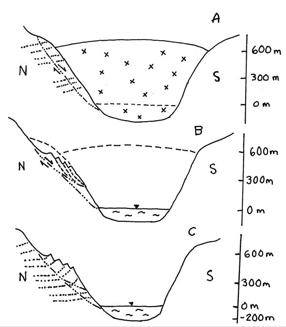
Figure 14.-- Sketch showing hypothetical subsurface model for Tidal Inlet landslide
movement involving LIA glacial retreat and debuttressing of slopes in Tidal Inlet.
A) Ice surface during maximum of LIA about AD 1800 with rupture surface of pre-LIA
landslide possibly extending below present shoreline; bedrock dipping slightly
to north, B) Initiation of recent rock slump with separate rotational blocks
(only 4 of 13 blocks represented) shortly following (1892-1919) removal of lateral
support for slope with glacial retreat from Tidal Inlet, and C) Present perched
landslide above shoreline of Tidal Inlet showing both recent and pre-LIA rupture
surfaces with more steeply dipping bedrock. Sketch shows approximate profile
that is not necessarily to scale.