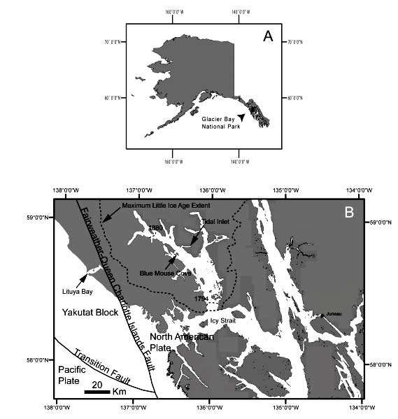
Figure 2.-- A) Location map of Glacier Bay National Park, Alaska and B) map showing
the locations of Tidal Inlet and Blue Mouse Cove along the western arm of Glacier
Bay, and Lituya Bay along the Pacific coast. Active faults systems of Fairweather-Queen
Charlotte Islands and Transition (from Brew et al., 1995), and extent of glacier
during Little Ice Age (dashed line) and approximate dates and locations of glacial
retreat in 1794 near Icy Strait and in 1879 in the northern part of the western
arm of Glacier Bay.