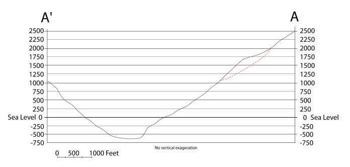
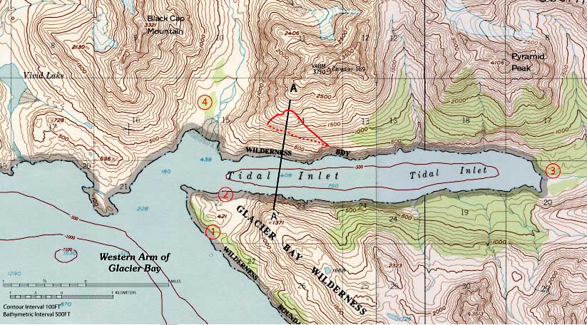
Figure 3A)-- Topographic map of Tidal Inlet, Glacier Bay National Park from USGS Mt. Fairweather (D-2) topographic map (scale 1:63,600 with contour interval of 100 feet). Outline of Tidal Inlet landslide shown in red. Points 1, 2, 3, and 4 referred to in text are shown as circled numbers in red. Simplified bathymetry from Hooge et al., (2000).