
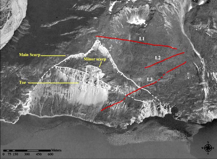
Figure 6.-- Vertical aerial photograph (1996) showing approximate boundaries
of
the Tidal Inlet landslide mass, excluding scarp areas. Main scarp, minor scarp,
and toe identify most recent landslide features. Extension of dashed line along
eastern and western flanks indicates possible boundary of previous pre-LIA landslide.
The dashed line of the toe indicates the maximum width of the recent landslide,
approximately 1230 m. The maximum length from the base of the center of the main
scarp down to the toe (perpendicular to width) is approximately 500 m. Lineaments
(LI, L2, and L3) are in proximity to the main scarp and left (east) flank of
the Tidal Inlet landslide.