
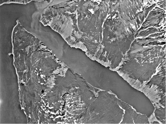
Figure 8.-- Portion of aerial photograph showing Tidal Inlet and eastern side
of
west arm Glacier Bay taken July 6, 1948. Note talus (bright light color) below
recent landslide mass above northern shore (upper left corner) extending from
landslide toe to shore of Tidal Inlet below central portion of landslide. Photograph
taken by US Navy at 1:40,000-scale.