Data Report of Aftershocks of the 03 November 2002, Mw 7.9, Denali Fault Earthquake Recorded Near the Fault Rupture at the Richardson Highway and Alyeska Pipeline
By David Carver, Timothy Plucinski, Arthur Frankel andErdal
Safak
U.S. Geological Survey Open-File Report 03-158
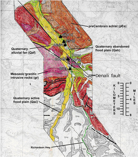
Scanned portion of a portion of the map “Preliminary engineering geologic maps o the proposed Trans-Alaska Pipeline route, Mount Hayes Quadrangle” showing
the surficial geology and the temporary array of accelerograph
stations that recorded Denali aftershocks.