
Data Report of Aftershocks of the 03 November 2002, Mw 7.9, Denali Fault Earthquake Recorded Near the Fault Rupture at the Richardson Highway and Alyeska Pipeline
By David Carver, Timothy Plucinski, Arthur Frankel and Erdal
Safak
U.S. Geological Survey Open-File Report 03-158
|
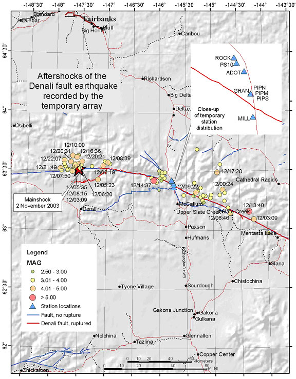
Map showing the locations of aftershocks recorded at 5 or more stations of our
temporary array. Events larger than 4.0 are labeled with date/time.
|
|