![]()
Digital depth horizon compilations of the Alaskan North Slope and adjacent arctic regions
By R.W. Saltus and K.J. Bird
U.S. Geological Survey Open-File Report 03-230
Version 1.1
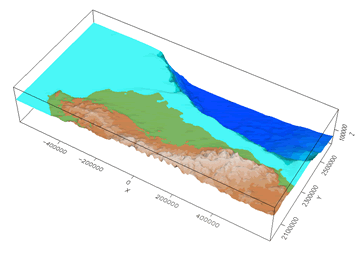
Data have been digitized and combined to create four detailed depth horizon grids spanning the Alaskan North Slope and adjacent offshore areas. These map horizon compilations were created to aid in petroleum system modeling and related studies.
| The text of this report is presented here in Portable Document Format. The latest version of Adobe Acrobat Reader or similar software is required to view it. If you wish to download the latest version of Acrobat Reader free of charge, click here . |
| OFR-03-230 PDF file (11.17 MB) |
(This version of the report is accessible as defined in Section 508.) |
| README TXT file (3 KB) |
Explanation of data files |
| DATA |
Directory containing gridded data
files Update Note: All files in the DATA directory have been updated with newer versions. The new depth horizon grids have been modified to correct spurious features along the mountain front to the south and east of the Colville Basin. Also, the Shublik interface in the State Lands region between NPRA and ANWR has been updated to better agree with well information in that region. |
| AccessibilityFOIAPrivacyPolicies and Notices | |
| |
|