RETURN TO MAIN STATE MAP  
Substantial Flood Peaks in Texas

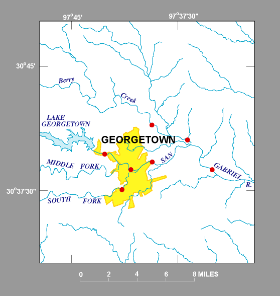
Peak streamflow and gage height for each station can be viewed by clicking on a red dot on the map or station name in the text links below the map. The elevation for each annual peak can be obtained by adding the peak gage height to the elevation for the gage datum above sea level.

Up-to-date files of annual-peak data also can be obtained on the internet at http://waterdata.usgs.gov/tx/nwis/peak


RETURN TO MAP SECTION 7
RETURN TO MAP SECTION 11

TEXT LINKS OF STATIONS

Streamflow-gaging stations in Georgetown Inset Map

Brazos River Basin
USGS Station 08104700 – N Fork San Gabriel River near Georgetown
USGS Station 08104795 – N Fork San Gabriel River Ups from SH 418, Georgetown
USGS Station 08104900 – S Fork San Gabriel River at Georgetown
USGS Station 08105000 – San Gabriel River at Georgetown


Brazos River Basin (continued)
USGS Station 08105100 – Berry Creek near Georgetown
USGS Station 08105200 – Berry Creek at SH 971 near Georgetown
USGS Station 08105300 – San Gabriel River near Weir


RETURN TO TOP OF PAGE