USGS: science for a changing world - www.usgs.gov

U.S. Geological Survey Open-File Report 2004-1003 

BROWSE THUMBNAIL IMAGE: Image showing extent and distribution of data layer coverage.

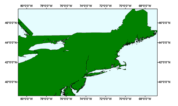
NOS80K/ALLUS80K: Medium Resolution Digital Vector U.S. Shoreline shapefile for the Long Island Sound GIS project area


Metadata also available as: FAQ - TEXT

Metadata:


Identification_Information:
Citation:
Citation_Information:
Originator:
National Oceanic and Atmospheric Administration (NOAA), National Ocean Service (NOS), Office of Coast Survey, and the Strategic Environmental Assessments (SEA) Division of the Office of Ocean Resources Conservation and Assessment (ORCA)
Publication_Date: 1994
Publication_Time: Unknown
Title:
NOS80K/ALLUS80K: Medium Resolution Digital Vector U.S. Shoreline shapefile Long Island Sound GIS project area
Edition: 1.0
Geospatial_Data_Presentation_Form: vector digital data
Publication_Information:
Publication_Place: Silver Spring, MD
Publisher: NOAA/NOS/ORCA/SEA
Online_Linkage: <http://seaserver.nos.noaa.gov/projects/shoreline/shoreline.html>
Online_Linkage: <ftp://seaserver.nos.noaa.gov/datasets/shoreline/shoreline.html>
Online_Linkage:
<http://coastalmap.marine.usgs.gov/GISdata/basemaps/coastlines/nos80k/nos80k.zip>
Larger_Work_Citation:
Citation_Information:
Originator: L.J. Poppe
Originator: V.F. Paskevich
Originator: M.S. Moser
Originator: M.L. DiGiacomo-Cohen
Originator: E.B. Christman
Publication_Date: 2004
Title:
Sidescan Sonar Imagery and Surficial Geologic Interpretation of the Sea Floor off Branford, Connecticut
Edition: 1.0
Series_Information:
Series_Name: Open-File Report
Issue_Identification: 2004-1003
Publication_Information:
Publication_Place: Woods Hole Science Center, Woods Hole, MA
Publisher: U.S. Geological Survey, Coastal and Marine Geology Program
Other_Citation_Details:
Data are released via CD-ROM media. This digital publication may also be available via the web at pubs.usgs.gov
Online_Linkage: <http://pubs.usgs.gov/of/2004/1003>
Online_Linkage: <http://woodshole.er.usgs.gov/openfile/of2004-1003>
Description:
Abstract:
NOAA's Medium Resolution 1:70,000 scale Digital Vector Shoreline is a high-quality, Geographic Information System-ready, general-use digital vector data set containing the coastline of the contiguous United States of America. It was created by the Strategic Environmental Assessments (SEA) Division of NOAA's Office of Ocean Resources Conservation and Assessment. Compiled from hundreds of NOAA coast charts, this product comprises over 75,000 nautical miles of coastline (nearly 2.5 million vectices).

The shoreline was created from data captured (digitized from scanned images of the master separates of the NOS Charts) from over 270 National Ocean Service Navigation Charts and spans some 80,000 nautical miles at an average map scale of 1:70,000.

This product comprises over 75,000 nautical miles of coastline (nearly 2.5 million vectices), representing the entire conterminous United States of America. Alaska, the Hawaiian Islands, Puerto Rico, and all other interests and territories of the United States are not included in the collection.

The data set is designed for a broad target audience ranging from governmental agencies, universities and other research institutions, to the private sector, and students, as well as any other concern requiring a general purpose digital shoreline layer for GIS and cartographic projects.

Purpose:
Because the ALLUS80K provides a higher detail of coastal inlets and waterways, this data layer was added to the GIS to provide a reasonable represntation of the coastline for the project area. This data layer is a subset of the complete ALLUS80k coastline and shapefile and has been clipped to the GIS project extent.
Supplemental_Information:
Generally, 1:80,000 NOAA coast charts took precedence and were used when available. For areas where 1:80,000 charts were not readily available, charts with the next closest higher scale (e.g., 1:60,0000) were used down to the highest scale available. Alternately, if higher scale charts were not available, charts of the closest lower scale (e.g., 1:100,000) were used down to the lowest scale. The digital shoreline for Florida was obtained from the state. This digital file was originally created from NOAA nautical charts and was not recreated by SEA. Generally, for these shoreline sections (EC80_06, GC80_05, and GC80_06), the highest scale charts available were used to digitize the shoreline. The resultant average mapping scale for the entire Medium Resolution Digital Vector Shoreline is approximately 1:70,000. See NOAA's Medium Resolution Digital Vector Shoreline website for more details on this product: <http://seaserver.nos.noaa.gov/projects/shoreline/shoreline.html>
Time_Period_of_Content:
Time_Period_Information:
Single_Date/Time:
Calendar_Date: 1994
Currentness_Reference: publication date
Status:
Progress: Complete
Maintenance_and_Update_Frequency: Unknown
Spatial_Domain:
Bounding_Coordinates:
West_Bounding_Coordinate: -80.845015
East_Bounding_Coordinate: -66.791978
North_Bounding_Coordinate: 47.415129
South_Bounding_Coordinate: 38.607004
Keywords:
Theme:
Theme_Keyword_Thesaurus: General
Theme_Keyword: NOAA
Theme_Keyword: Digital Vector Shoreline
Theme_Keyword: ArcView shapefile
Theme_Keyword: Digital Geographic Boundaries
Theme_Keyword: shore
Theme_Keyword: shoreline
Theme_Keyword: coast
Theme_Keyword: coastal features
Theme_Keyword: Open-File Report 2004-1003
Theme_Keyword: OFR 2004-1003
Place:
Place_Keyword_Thesaurus: General
Place_Keyword: United States
Place_Keyword: continental US
Place_Keyword: conterminous US
Place_Keyword: US 48 states
Place_Keyword: northeast United States
Place_Keyword: New England
Access_Constraints: None
Use_Constraints:
Public domain data are freely redistributable with proper metadata and source attribution.

Not to be used for Navigational Purposes.

Point_of_Contact:
Contact_Information:
Contact_Person_Primary:
Contact_Person: Steve Rohmann
Contact_Organization: NOAA/NOS/SEA/ORCA
Contact_Address:
Address_Type: mailing and physical address
Address: NOAA
Address: N/ORCA1
Address: 9th Floor
Address: 1305 East-West Highway
City: Silver Spring
State_or_Province: MD
Postal_Code: 20910
Country: USA
Contact_Voice_Telephone: (301) 713-3000 x137
Contact_Facsimile_Telephone: (301) 713-4384
Contact_Electronic_Mail_Address: srohmann@seamail.nos.noaa.gov
Browse_Graphic:
Browse_Graphic_File_Name: nos80k
Browse_Graphic_File_Description:
Overview showing the extent of the clipped ALLUS80K shapefile (NOS80k) for the GIS project area.
Browse_Graphic_File_Type: GIF
Data_Set_Credit:
Please credit National Oceanic and Atmospheric Administration (NOAA), National Ocean Service (NOS), Office of Coast Survey, and the Strategic Environmental Assessments (SEA) Division of the Office of Ocean Resources Conservation and Assessment (ORCA) as the originator of the dataset.
Native_Data_Set_Environment:
Microsoft Windows 2000 Version 5.1 (Build 2600) Service Pack 1; ESRI ArcCatalog 8.3.0.800
Cross_Reference:
Citation_Information:
Originator: Larry Poppe
Originator: Valerie Paskevich
Publication_Date: 2002
Title:
Geological Framework Data from Long Island Sound, 1981-1990: A Digital Data Release
Edition: 1.0
Series_Information:
Series_Name: Open-File Report
Issue_Identification: 02-002
Publication_Information:
Publication_Place: Woods Hole Science Center, Woods Hole, MA
Publisher: U.S. Geological Survey, Coastal and Marine Geology Program
Online_Linkage: <http://woodshole.er.usgs.gov/openfile/of02-002>
Cross_Reference:
Citation_Information:
Originator: V.F. Paskevich (editor)
Originator: L.J. Poppe (editor)
Publication_Date: 2000
Title:
Georeferenced Mapping and Bottom Photography in Long Island Sound
Edition: 1.0
Series_Information:
Series_Name: Open-File Report
Issue_Identification: 00-304
Publication_Information:
Publication_Place: Woods Hole Science Center, Woods Hole, MA
Publisher: U.S. Geological Survey, Coastal and Marine Geology Program
Online_Linkage: <http://pubs.usgs.gov/openfile/of00-304/>

Data_Quality_Information:
Attribute_Accuracy:
Attribute_Accuracy_Report:
The data supplied here are a compilation of information collected from some 270+ current or pre-release National Ocean Service Navigation Charts. In compiling this product we made no attempt to ascertain the congruency between the charted data, and the real world. Our objective was to simply capture the representative coastline as provided to us via the NOS Chart. Every effort was made to capture the shoreline on these charts as faithfully as our skills and technology allowed, and there is every indication that we were successful to this end. However, in doing so, we automatically conveyed the character (all aspects, both good and bad) of those data to our digital product. A character which may or may not be in agreement with the real world. Because of this, the user is advised to exercise caution in making any assumptions about the fallibility, or infallibility, of the spatial information supplied here; especially when circumstances warrant a high degree of absolute positional accuracy.

Spatial data were derived directly from National Ocean Service Navigation Charts. The NOS Chart Products meet or exceed National Map Accuracy standards (hard copy); the digital data supplied in this compilation should, when plotted at scale, meet or exceed these same cartographic standards.

Logical_Consistency_Report:
No additional checks for topological consistency were performed on this data set.
Completeness_Report: This data set is a subset of the complete ALLUS80K shapefile.
Positional_Accuracy:
Horizontal_Positional_Accuracy:
Horizontal_Positional_Accuracy_Report:
The data supplied here are a compilation of information collected from some 270+ current or pre-release National Ocean Service Navigation Charts. In compiling this product we made no attempt to ascertain the congruency between the charted data, and the real world. Our objective was to simply capture the representative coastline as provided to us via the NOS Chart. Every effort was made to capture the shoreline on these charts as faithfully as our skills and technology allowed, and there is every indication that we were successful to this end. However, in doing so, we automatically conveyed the character (all aspects, both good and bad) of those data to our digital product. A character which may or may not be in agreement with the real world. Because of this, the user is advised to exercise caution in making any assumptions about the fallibility, or infallibility, of the spatial information supplied here; especially when circumstances warrant a high degree of absolute positional accuracy.
Lineage:
Source_Information:
Source_Scale_Denominator: 80000
Type_of_Source_Media: paper
Source_Citation_Abbreviation: allus80k.shp
Process_Step:
Process_Description:
The complete ALLUS80K shapefile was clipped to the GIS project extent.
Source_Used_Citation_Abbreviation: allus80k.dbf
Source_Used_Citation_Abbreviation: allus80k.shp
Source_Used_Citation_Abbreviation: allus80k.shx
Process_Date: 20040213
Source_Produced_Citation_Abbreviation: nos80k.dbf
Source_Produced_Citation_Abbreviation: nos80k.shp
Source_Produced_Citation_Abbreviation: nos80k.shx
Process_Contact:
Contact_Information:
Contact_Person_Primary:
Contact_Person: Valerie Paskevich
Contact_Organization: U.S. Geological Survey
Contact_Position: Information Specialist / GIS Coordinator
Contact_Address:
Address_Type: mailing and physical address
Address: 384 Woods Hole Road
City: Woods Hole
State_or_Province: MA
Postal_Code: 02543-1598
Country: USA
Contact_Voice_Telephone: (508) 548-8700 x2281
Contact_Facsimile_Telephone: (508) 457-2310
Contact_Electronic_Mail_Address: vpaskevich@usgs.gov

Spatial_Data_Organization_Information:
Direct_Spatial_Reference_Method: Vector
Point_and_Vector_Object_Information:
SDTS_Terms_Description:
SDTS_Point_and_Vector_Object_Type: G-polygon
Point_and_Vector_Object_Count: 5306

Spatial_Reference_Information:
Horizontal_Coordinate_System_Definition:
Geographic:
Latitude_Resolution: 0.000000
Longitude_Resolution: 0.000000
Geographic_Coordinate_Units: Decimal degrees
Geodetic_Model:
Horizontal_Datum_Name: North American Datum of 1983
Ellipsoid_Name: Geodetic Reference System 80
Semi-major_Axis: 6378137.000000
Denominator_of_Flattening_Ratio: 298.257222
Vertical_Coordinate_System_Definition:
Altitude_System_Definition:
Altitude_Datum_Name: North American Datum of 1983

Entity_and_Attribute_Information:
Detailed_Description:
Entity_Type:
Entity_Type_Label: nos80k
Entity_Type_Definition: Shapefile Attribute Table
Entity_Type_Definition_Source: None
Attribute:
Attribute_Label: FID
Attribute_Definition: Internal feature number.
Attribute_Definition_Source: ESRI
Attribute_Domain_Values:
Unrepresentable_Domain:
Sequential unique whole numbers that are automatically generated.
Attribute:
Attribute_Label: Shape
Attribute_Definition: Feature geometry.
Attribute_Definition_Source: ESRI
Attribute_Domain_Values:
Unrepresentable_Domain: Coordinates defining the features.
Attribute:
Attribute_Label: ID

Distribution_Information:
Distributor:
Contact_Information:
Contact_Person_Primary:
Contact_Person: Steve Rohmann
Contact_Organization: NOAA, N/ORCA1
Contact_Address:
Address_Type: mailing and physical address
Address: NOAA
Address: N/ORCA1
Address: 9th Floor
Address: 1305 East-West Highway
City: Silver Spring
State_or_Province: MD
Postal_Code: 20910
Country: USA
Contact_Voice_Telephone: (301) 713-3000 x137
Contact_Facsimile_Telephone: (301) 713-4384
Contact_Electronic_Mail_Address: rohmann@seamail.nos.noaa.gov
Resource_Description:
Downloadable Data: Medium Resolution Digital Vector U.S. Shoreline [OL 72 18.7 -66.5 -168]
Distribution_Liability:
Although this data has been processed successfully on a computer system at the NOAA, no warranty, expressed or implied, is made by NOAA regarding the utility of the data on any other system, nor shall the act of distribution constitute any such warranty. NOAA warrants the delivery of this product in computer-readable format, and will offer a replacement copy of the product when the product is determined unreadable by computer input peripherals, or when the physical medium is delivered in damaged condition.

Although this derived data set and its lineage dataset have been used by the USGS, no warranty, expressed or implied, is made by the USGS as to the accuracy of the data and/or related materials. The act of distribution shall not constitute any such warranty, and no responsibility is assumed by the USGS in the use of these data or related materials.

Standard_Order_Process:
Digital_Form:
Digital_Transfer_Information:
Format_Name: ArcView Shapefile
Format_Version_Number: 3.2
Format_Specification: ESRI polygon shapefile
Format_Information_Content:
The five files (nos80k.dbf, nos80k.shp, nos80k.shx) that comprise the ArcView shapefile, 'prj' and 'avl' files, browse graphic and an ASCII version of the metadata.
File_Decompression_Technique: zip
Transfer_Size: 38.544
Digital_Transfer_Option:
Offline_Option:
Offline_Media: CD-ROM
Recording_Capacity:
Recording_Density: 650
Recording_Density_Units: Mbyte
Compatibility_Information:
The user must have a computer system with a CD-ROM available. To browse the information contained on this CD-ROM, the user must have a current WWW browser available. The user must also have software installed on their computer to unzip the archived file.
Technical_Prerequisites:
The base map overlay is available in the ESRI shapefile format. The user must have Environmental Systems Research Institute's (ESRI) ArcView 3.0 or greater or ArcGIS software to read and process the data file. In lieu of Arcview, the user may utilize another GIS application package capable of importing the data. A free GIS data viewer, ArcExplorer, is available from the ESRI website at www.esri.com/software/arcexplorer/download4.html

Access to the data and information contained on this CD-ROM was developed using the HyperText Markup Language (HTML) utilized by the World Wide Web (WWW) project. Development of the CD-ROM documentation and user interface in HTML allows a user to access the information by using a variety of WWW information browsers to facilitate browsing and locating information and data. To access the information contained on this disk with a WWW client browser, open the file 'index.htm' at the top level directory of this CD-ROM with your selected browser.

This CD-ROM should be readable by a variety of operating systems including Windows 95/98/NT, Macintosh and UNIX.


Metadata_Reference_Information:
Metadata_Date: 20040214
Metadata_Contact:
Contact_Information:
Contact_Organization_Primary:
Contact_Organization: U. S. Geological Survey
Contact_Person: Valerie Paskevich
Contact_Position: Information Specialist / GIS Coordinator
Contact_Address:
Address_Type: mailing and physical address
Address: 384 Woods Hole Rd.
City: Woods Hole
State_or_Province: MA
Postal_Code: 02543
Country: USA
Contact_Voice_Telephone: (508) 548-8700 x2281
Contact_Facsimile_Telephone: (508) 457-2310
Contact_Electronic_Mail_Address: vpaskevich@usgs.gov
Metadata_Standard_Name: FGDC Content Standards for Digital Geospatial Metadata
Metadata_Standard_Version: FGDC-STD-001-1998
Metadata_Time_Convention: local time
Metadata_Access_Constraints: None
Metadata_Use_Constraints: None

Generated by mp version 2.7.33 on Sat Feb 14 14:27:31 2004