|
|
|
|
|
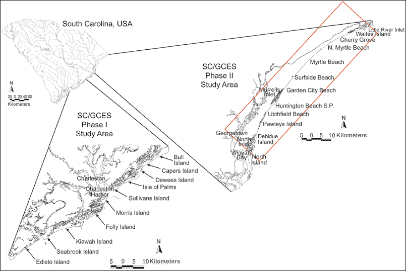
Figure 1. Regional map display. Inset map of South Carolina and blow up images of the South Carolina portions of both Phase I and Phase II study areas for the South Carolina/Georgia Coastal Erosion Study. Islands, beaches and major water bodies are labeled. Detailed location map from Figure 2 is outlined in red within the Phase II study area (modified from Baldwin, 2002).
|
Can't see the printable PDF version? Get the free Adobe Acrobat® Reader. |