|
|
|
|
|
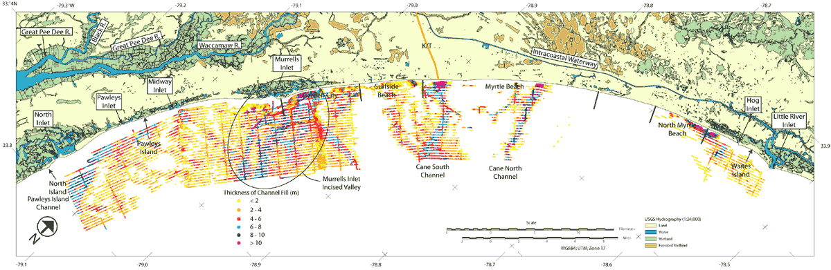
Figure 14. Map showing the locations and thickness of fill associated with paleochannels identified within the seismic reflection data. Indications of paleochannel incision have been interpreted as concave up erosional unconformities that truncate strata of increasing age. Values are presented as approximate depths in meters (assuming a seismic velocity of 1500 m/s). In most cases, these incisions dissect underlying tilted strata of Cretaceous/Tertiary age.
|
Can't see the printable PDF version? Get the free Adobe Acrobat® Reader. |