Maps Showing the Stratigraphic Framework of South Carolina's Long Bay from Little River to Winyah Bay
USGS Open File Report 2004-1013
by: Wayne E. Baldwin, Robert A. Morton, Jane F. Denny, Shawn V. Dadisman, William C. Schwab, Paul T. Gayes, and Neal W. Driscoll
return to Mapping Results: Seismic stratigraphy - Thickness and Distribution of Modern Sediment
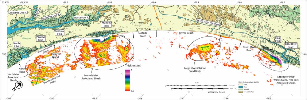
Figure 17. Map showing the thickness of modern surficial sediment accumulation. Measurements of surficial sediment lenses within CHIRP seismic data were used to generate this isopach grid. Thickness values are presented in meters (assuming a seismic velocity of 1500 m/s.) White areas indicate surficial sediment measurements of less than 0.5 m.
return to Mapping Results: Seismic stratigraphy - Thickness and Distribution of Modern Sediment

[an error occurred while processing this directive]
