|
|
|
|
|
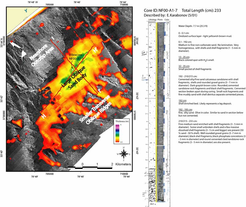
Figure 19. Side-Scan Sonar coverage (left, location outlined in Figure 7) overlain by surficial sediment accumulation grid, showing the orientation and sediment thickness associated with the large shore oblique sand body that trends in a NE - SW direction across the inner continental shelf offshore of Myrtle Beach. The feature is ~ 11 km long along its axis, and ~ 3 km at its widest point. In some areas, sediment accumulation within the feature is in excess of 3 m. Vibracore sample NF00-A1-7 (right, location above and in Figure 7) illustrates the sediment type within the feature, as well as the transgressive surface beneath. The feature is considered anomalous, because it is one of the only significant accumulations of surficial sediment that is non-inlet related, and lies north of the inferred Cretaceous/Tertiary boundary. Seismic profiles H - H' and I - I', depicted in Figure 18 (outlined at left, and in Figure 7), provide vertical cross sections of the sub-surface in this area.
|
Can't see the printable PDF version? Get the free Adobe Acrobat® Reader. |