Link to USGS home page Link to USGS home page
Coastal and Marine Geology Program
Coastal & Marine Geology Program > South Carolina Coastal Erosion Study > Open File Report 2004-1013

Maps Showing the Stratigraphic Framework of South Carolina's Long Bay from Little River to Winyah Bay

USGS Open File Report 2004-1013

by: Wayne E. Baldwin, Robert A. Morton, Jane F. Denny, Shawn V. Dadisman, William C. Schwab, Paul T. Gayes, and Neal W. Driscoll

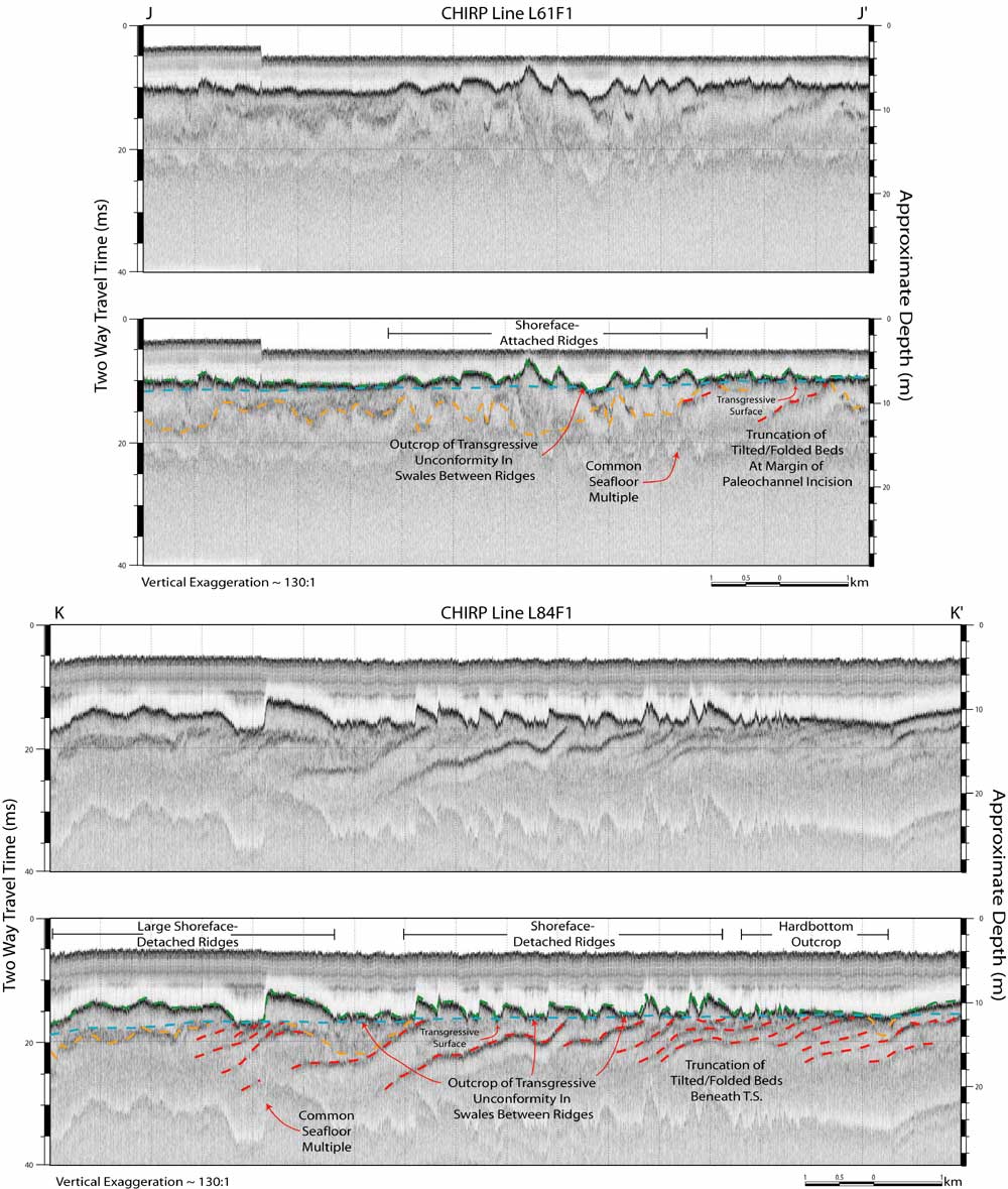
Figure 20. CHIRP sub-bottom profiles with interpretations from the shoreface-attached and shoreface-detached ridges offshore Pawleys Island. These profiles provide sub-bottom images of the features, illustrating their cross sectional profiles. The images also illustrate how the strata underlying the features crop out in the swales between them. Vertical scales for sub-bottom profiles are provided in both milliseconds (Two-Way Travel Time) and approximate depth in meters (assuming a seismic velocity of 1500 m/s). Locations for profiles J - J' and K - K' are outlined in Figure 7.

Printable version of Figure 20.Printable Version of Fig. 20 (7 MB PDF)
Can't see the printable PDF version? Get the free Adobe Acrobat® Reader.

CHIRP sub-bottom profiles with interpretations from the shoreface-attached and shoreface-detached ridges offshore Pawleys Island.

Coastal & Marine Geology Program > South Carolina Coastal Erosion Study > Open File Report 2004-1013


[an error occurred while processing this directive]