Skip past header information USGS Logo with link to USGS web page
Coastal Vulnerability Assessment of Assateague Island National Seashore (ASIS) to Sea-Level Rise, USGS Open-File Report 2004-1020


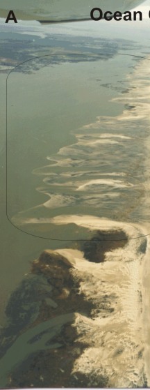
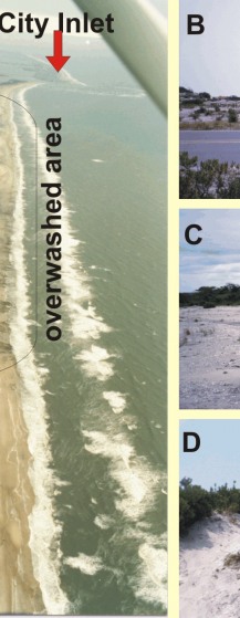
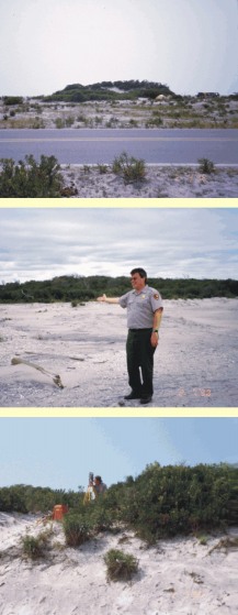
Back to Title Page

Figure 3. A) Northern Assateague Island showing an area that is low and overwashed (5 - very high vulnerability). B, C, and D) show dunes along Assateague Island. Areas with a mature dune ridge were categorized as 4 - high vulnerability (photos courtesy of Rebecca Beavers and Melanie Ransmeier).


Figure 3. A) Northern Assateague Island showing an area that is low and overwashed (5 - very high vulnerability) B, C, and D) show dunes along Assateague Island.  Areas with a mature dune ridge were categorized as 4 - high vulnerability. Figure 3. A) Northern Assateague Island showing an area that is low and overwashed (5 - very high vulnerability) B, C, and D) show dunes along Assateague Island.  Areas with a mature dune ridge were categorized as 4 - high vulnerability. Figure 3. A) Northern Assateague Island showing an area that is low and overwashed (5 - very high vulnerability) B, C, and D) show dunes along Assateague Island.  Areas with a mature dune ridge were categorized as 4 - high vulnerability.

Skip Footer Information
Department of Interior
 /  U.S. Geological Survey  /  Coastal and Marine Geology / 

USGS Privacy Statement  /  Disclaimer  /  Accessibility
This is http://pubs.usgs.gov/pubs/of/2004/1020/html/fig3.html
Maintained by Eastern Publications Web Team
Modified Saturday, 12-Jan-2013 23:20:27 EST