Skip past header information USGS Logo with link to USGS web page
Coastal Vulnerability Assessment of Assateague Island National Seashore (ASIS) to Sea-Level Rise, USGS Open-File Report 2004-1020


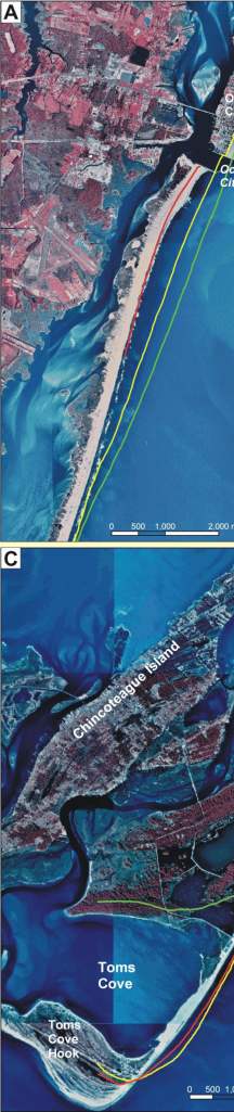
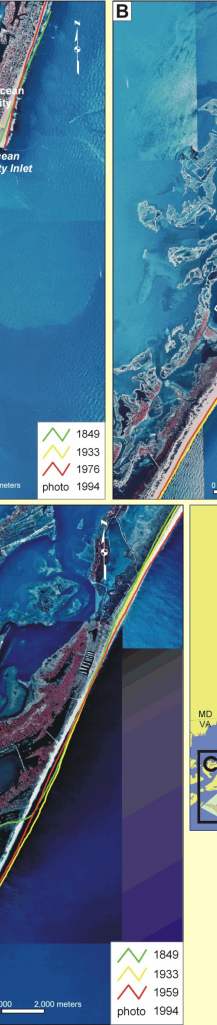
Back to Title Page

Figure 4. Historic Shoreline positions for A) northern, B) south-central, C) and southern Assateague Island.


Figure 4. Historic Shoreline positions for A) northern, B) south-central, C) and southern Assateague Island. Figure 4. Historic Shoreline positions for A) northern, B) south-central, C) and southern Assateague Island. Figure 4. Historic Shoreline positions for A) northern, B) south-central, C) and southern Assateague Island.

Skip Footer Information
Department of Interior
 /  U.S. Geological Survey  /  Coastal and Marine Geology / 

USGS Privacy Statement  /  Disclaimer  /  Accessibility
This is http://pubs.usgs.gov/pubs/of/2004/1020/html/fig4.html
Maintained by Eastern Publications Web Team
Modified Saturday, 12-Jan-2013 23:20:28 EST