
Coastal Vulnerability Assessment of Assateague Island National Seashore (ASIS) to Sea-Level Rise, USGS Open-File Report 2004-1020
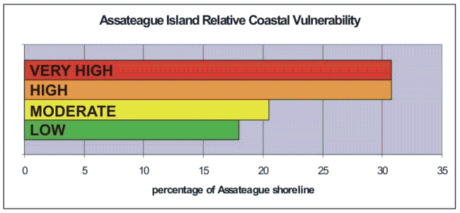
Back to Title Page Figure 6. Percentage of ASIS shoreline in each CVI vulnerability category. | ||
 |
||

|
Coastal Vulnerability Assessment of Assateague Island National Seashore (ASIS) to Sea-Level Rise, USGS Open-File Report 2004-1020
| ||||