Link to data for Montemalaga Elementary School. Link to data for Silver Spur Elementary School. Link to data for Cornerstone Elementary School. Link to data for Rancho Vista Elementary School. Link to data for Soleado Elementary School. Link to data for Dapplegray Elementary School. Link to data for Vista Grande Elementary School. Link to data for Lunada Bay Elementary School. Link to data for Point Vicente Elementary School. Link to data for Mira Catalina Elementary School. Link to data for Palos Verdes Intermediate School. Link to data for Miraleste Intermediate School. Link to data for Miraleste Satellite School. Link to data for Palos Verdes High School. Link to data for Rancho del Mar High School. Link to Palos Verdes Peninsula High School data. Link to Malaga Cove School data. Link to information for Ridgecrest Intermediate School.

Map of Schools of the PVPUSD

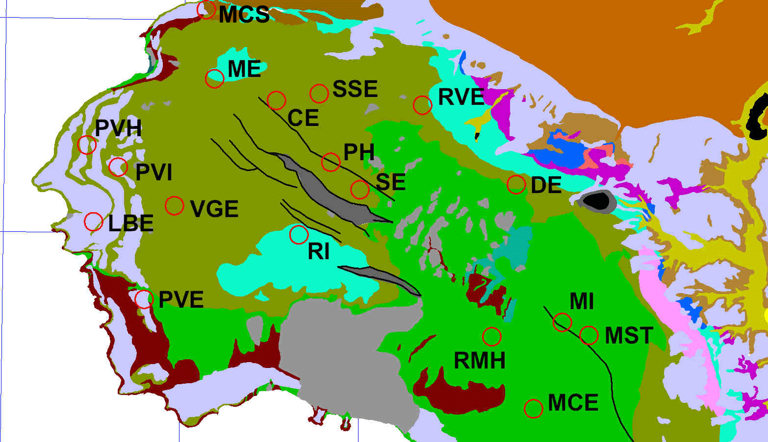
The map below shows the schools of the PVPUSD plotted on the geology as mapped by Dibblee (1999). Click here to view a table of the school names versus the codes plotted on the map. The darker green color corresponds to the upper part of the Altamira Shale, the light green to the lower part of the Altamira Shale, the light blue (cyan) to the Valmonte Diatomite, the light bluish gray to older alluvium deposited on marine terraces, and the dark red to basalt. To access information about other geologic units on the map, click here to view a version of the map with a geologic index. Click on a school code to view data specific to that school.


Image showing locations of schools of the Palos Verdes Peninsula Unified School District.


[an error occurred while processing this directive]