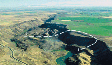
| The Bluegill landslide, located in south-central Idaho, is part of a larger landslide complex that forms an area in the Salmon Falls Creek drainage named Sinking Canyon. The landslide is on public property administered by the U.S. Bureau of Land Management (BLM). As part of ongoing efforts to address possible public safety concerns, the BLM requested that the U.S. Geological Survey (USGS) conduct a preliminary hazard assessment of the landslide, examine possible mitigation options, and identify alternatives for further study and monitoring of the landslide. This report presents the findings of that assessment based on a field reconnaissance of the landslide on September 24, 2003, a review of data and information provided by BLM and researchers from Idaho State University, and information collected from other sources. |