Skip past header information USGS Logo with link to USGS web page
Coastal Vulnerability Assessment of Cape Hatteras National Seashore to Sea-Level Rise, USGS Open-File Report 2004-1064
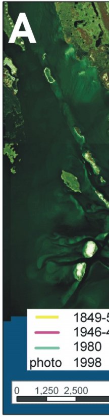
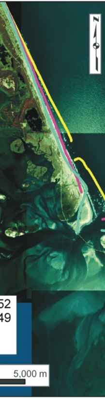
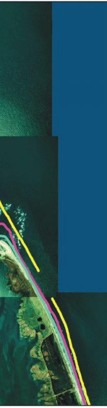

Figure 12A. Historic shoreline positions for A) Bodie Island and Pea Island NWR near Oregon Inlet.


Figure 12A.  Historic shoreline positions for A) Bodie Island and Pea Island NWR near Oregon Inlet. Figure 12A.  Historic shoreline positions for A) Bodie Island and Pea Island NWR near Oregon Inlet. Figure 12A.  Historic shoreline positions for A) Bodie Island and Pea Island NWR near Oregon Inlet.

Skip Footer Information [an error occurred while processing this directive]