Skip past header information USGS Logo with link to USGS web page
Coastal Vulnerability Assessment of Cape Hatteras National Seashore to Sea-Level Rise, USGS Open-File Report 2004-1064


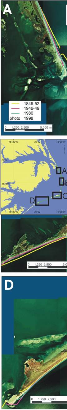
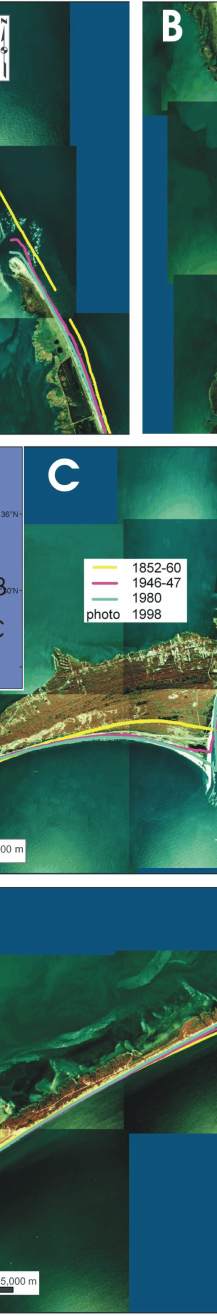
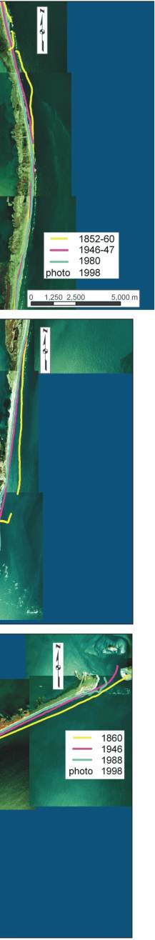
Figure 12 A-D. Historic shoreline positions for A) Bodie Island and Pea Island NWR on either side of Oregon Inlet; very high vulnerability B) Rodanthe; moderate to high vulnerability, C) Cape Point, Buxton, Frisco, Hatteras Village; very high to very low vulnerability, and D) Ocracoke Island; moderate to very high vulnerability. The figure locations are shown on inset map.


Figure 12 A-D.  Historic shoreline positions for Bodie Island and Pea Island,  Rodanthe, Cape Point, Buxton, Frisco, Hatteras Village and Ocracoke Island. Figure 12 A-D.  Historic shoreline positions for Bodie Island and Pea Island,  Rodanthe, Cape Point, Buxton, Frisco, Hatteras Village and Ocracoke Island. Figure 12 A-D.  Historic shoreline positions for Bodie Island and Pea Island,  Rodanthe, Cape Point, Buxton, Frisco, Hatteras Village and Ocracoke Island.

Skip Footer Information [an error occurred while processing this directive]