
Coastal Vulnerability Assessment of Cape Hatteras National Seashore to Sea-Level Rise, USGS Open-File Report 2004-1064
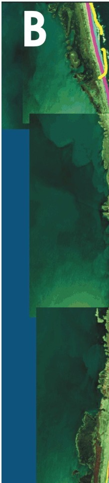
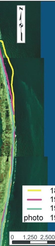
Figure 12B. Historic shoreline positions for B) Rodanthe. | ||
 |
 |
 |

|
Coastal Vulnerability Assessment of Cape Hatteras National Seashore to Sea-Level Rise, USGS Open-File Report 2004-1064
| ||||||