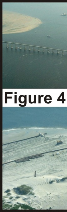
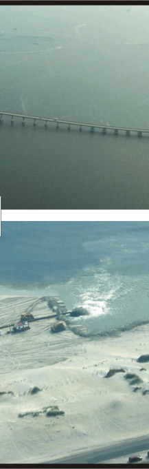
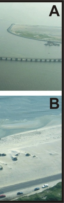
Skip past header information USGS Logo with link to USGS web page
Coastal Vulnerability Assessment of Cape Hatteras National Seashore to Sea-Level Rise, USGS Open-File Report 2004-1064


Figure 4.

A) The Bonner Bridge crosses Oregon Inlet and connects Bodie Island to Pea Island National Wildlife Refuge (NWR). Dredging takes place frequently within Oregon Inlet to maintain a navigation channel.

B) Sand dredged from Oregon Inlet is being pumped onto the beach within Pea Island NWR. Pea Island is ranked as a very high vulnerability area.


Figure 4.  A) The Bonner Bridge crosses Oregon Inlet and connects Bodie Island to Pea Island National Wildlife Refuge (NWR).  B) Sand dredged from Oregon Inlet is being pumped onto the beach within Pea Island NWR. Pea Island is ranked as a very high vulnerability area. Figure 4.  A) The Bonner Bridge crosses Oregon Inlet and connects Bodie Island to Pea Island National Wildlife Refuge (NWR).  B) Sand dredged from Oregon Inlet is being pumped onto the beach within Pea Island NWR. Pea Island is ranked as a very high vulnerability area. Figure 4.  A) The Bonner Bridge crosses Oregon Inlet and connects Bodie Island to Pea Island National Wildlife Refuge (NWR).  B) Sand dredged from Oregon Inlet is being pumped onto the beach within Pea Island NWR. Pea Island is ranked as a very high vulnerability area.

Skip Footer Information [an error occurred while processing this directive]