![[Link to USGS home page]](images/wrcmgbnr.gif)
![]()
![]()
| Predicted Seafloor Facies of Central Santa Monica Bay, California |
Ground-truth predicted seafloor facies with bottom photographs
|
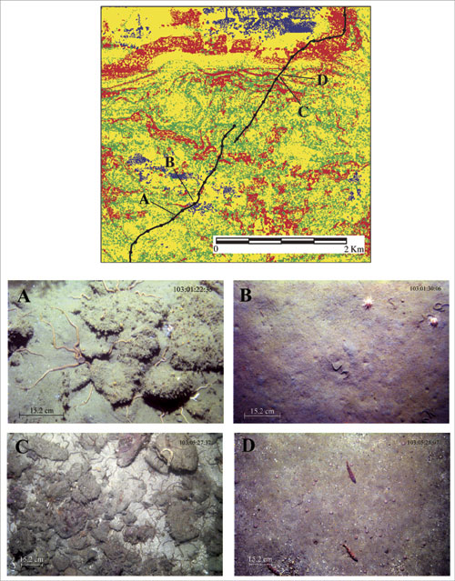
Figure 7. Comparisons between predicted seafloor facies and bottom photographs. Red in the facies map are exposed rock, green are areas of gravelly muddy sand, yellow are areas of muddy sand, and blue are areas of mud. The black line on the facies map is the camera sled path and the black dots are 5-min markers. |
 |
![[Reports]](images/nav_rprt.gif) |
 |
![[Home]](images/nav_home.gif) |
|
![[Search]](images/nav_srch.gif) |
 |