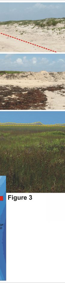
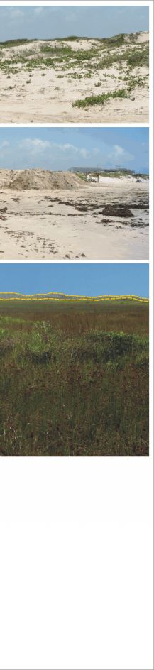
Figure 3. Northern Padre Island National Seashore (very high vulnerability with respect to geomorphology);
A) Dunes along the Gulf side of Padre Island. This photo was taken north of the 4-wheel drive only area. High vehicle traffic here suppresses the formation and growth of coppice dunes (incipient dunes that generally form around vegetation at the base of the foredune ridge). The red-hatched lines show the vehicle path at the base of the foredune.
B) Beach raking in front of the Malaquite Beach Visitor's Center provides a Sargassum free beach area for visitors, however these mounds of sand and seaweed are less stable than naturally vegetated dunes.
C) Heavily vegetated backbarrier flat with small pond and marsh areas (not visible in photo). The Gulf-facing foredune ridge is outlined in gold, the dune ridge is not very high (compared to central PAIS) here but mostly continuous with just a few low areas.
|