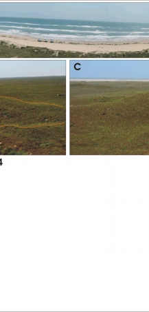
Figure 4A-C. Central Padre Island National Seashore (very high vulnerability with respect to geomorphology):
A) View of Big Shell Beach from the highest point in the park, Green Hill (panoramically distorted).
B) Stabilized blowout dune (outlined in yellow) near Green Hill. Central Padre island became more vegetated and many migrating dunes stabilized after the end of long droughts in the 1930's and 1950's (White and Others, 1979). Also the removal of cattle aided in dune stablization and vegetation.
C) View of the hummocky well vegetated backbarrier looking towards Laguna Madre from Green Hill.
|