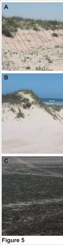
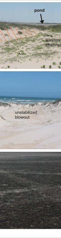
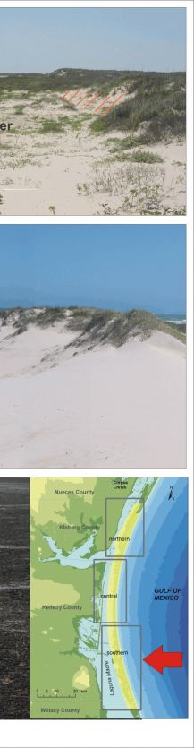
Figure 5. Southern Padre Island National Seashore (very high vulnerability with respect to geomorphology);
A) Washover channel (from Hurricane Bret) backed by a pond.
B) An unstabilized blowout dune. Unlike central PAIS, the southern part of the national seashore is less vegetated, so the dunes are more active and more vulnerable.
C) An extensive wind tidal flat in the backbarrier near Laguna Madre that has developed an algal mat on the surface of the sand and mud. These environments form in all sections of PAIS, but seem to be most extensive and continuous to the south.
|