
Coastal Vulnerability Assessment of Padre Island National Seashore to
Sea-Level Rise, USGS Open-File Report 2004-1090.
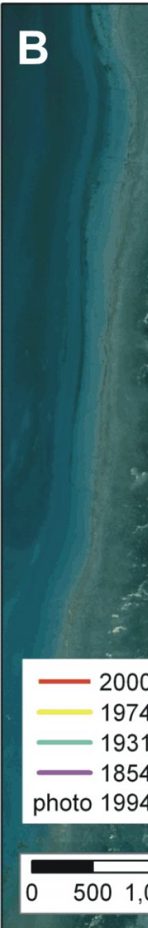
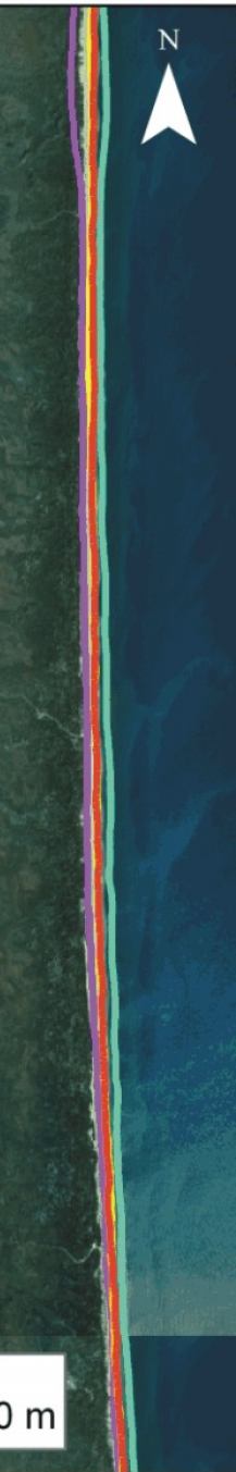
Figure 6B. Historic Shoreline positions for central PAIS - Big Shell Beach area. | ||
 |
 |
 |

|
Coastal Vulnerability Assessment of Padre Island National Seashore to Sea-Level Rise, USGS Open-File Report 2004-1090.
| ||||||