
Coastal Vulnerability Assessment of Padre Island National Seashore to
Sea-Level Rise, USGS Open-File Report 2004-1090.
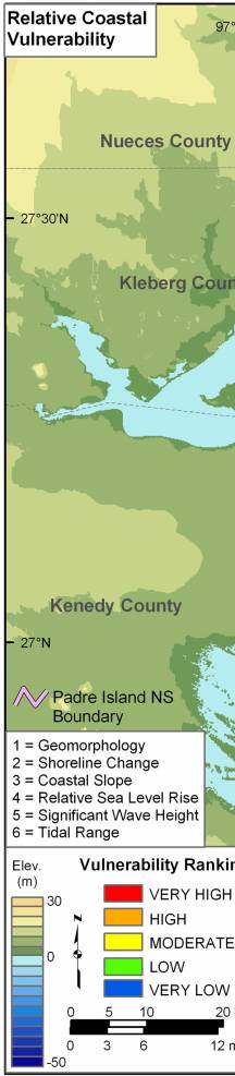
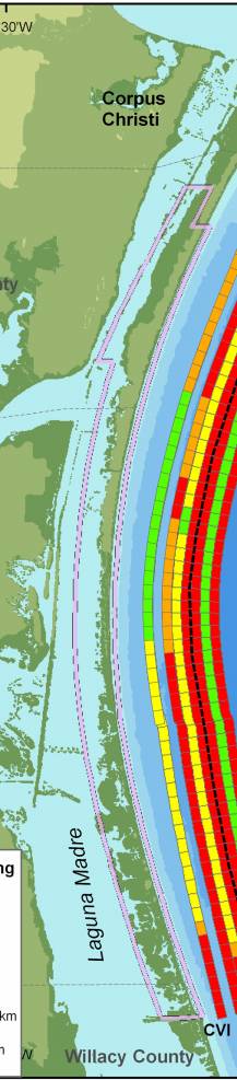
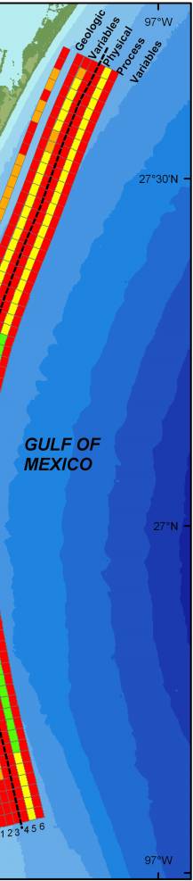
Figure 8. Relative Coastal Vulnerability for Padre Island National Seashore. The innermost color bar is the relative coastal vulnerability index (CVI). The remaining color bars are separated into the geologic variables (1-3) and physical process variables (4 - 6). The very high vulnerability shoreline as defined by the CVI is located in washover or low dune areas where rates of shoreline erosion are highest. The low vulnerability shoreline is located in the central part of the island where dune ridges are high and continuous and shoreline accretion occurs. | ||
 |
 |
 |
