Back to Figure 4 A-E
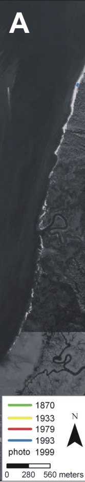
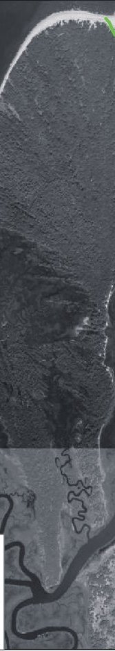
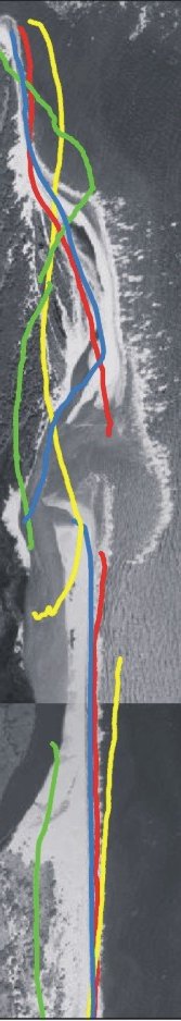
Figure 4A. Historic shoreline positions for Little Cumberland Island, Christmas Creek area, and Long Point.