
Coastal Vulnerability Assessment of Cumberland Island National Seashore to
Sea-Level Rise, USGS Open-File Report 2004-1196
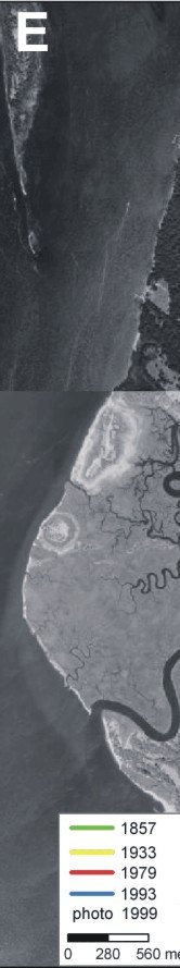
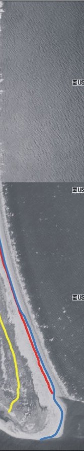
Figure 4E. Sea Camp Beach to north jetty at St. Marys entrance. | ||
 |
 |
 |

|
Coastal Vulnerability Assessment of Cumberland Island National Seashore to Sea-Level Rise, USGS Open-File Report 2004-1196
| ||||||