Skip past header information
USGS Logo with link to USGS Web page

Coastal Vulnerability Assessment of Gateway National Recreation Area to Sea-Level Rise
USGS Open-File Report 2004-1257

Back to Title Page

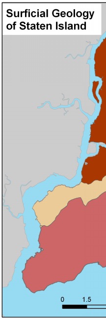
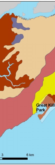
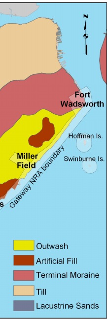
Figure 2. Surficial geology map for Staten Island (based on data from the NY Geological Survey) (Soren, 1988).


Figure 2.   Surficial geology map for Staten Island. Figure 2. Surficial geology map for Staten Island.Surficial geology map for Staten Island. Figure 2. Surficial geology map for Staten Island.

Skip Footer Information