
Coastal Vulnerability Assessment of Gateway National Recreation Area to Sea-Level Rise
USGS Open-File Report 2004-1257
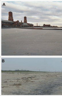
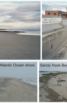
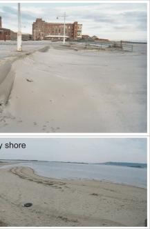
Figure 4. Photos of the very high vulnerability barrier island geomorphology within Breezy Point District and Sandy Hook Unit of Gateway National Recreation Area. A) Photos from the Breezy Point District at Jacob Riis Park show the beach with a series of groins fronting the bathhouse (left) and storm overwash and erosion along the base of the boardwalk (right). B) The Atlantic Ocean shoreline of Sandy Hook looking north from Gunnison Beach (left) and the Sandy Hook Bay shoreline at the entrance to Spermaceti Cove (right). | ||
 |
 |
 |
