
Relative Coastal Change-Potential Assessment of Kenai Fjords National Park
USGS Open-File Report 2004-1373
|
Relative Coastal Change-Potential Assessment of Kenai Fjords National Park USGS Open-File Report 2004-1373 |
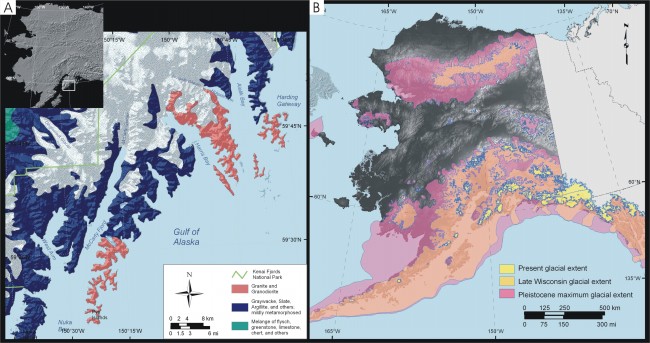
Figure 3. A) Geology of Kenai Fjords National Park. This figure is produced from a USGS Geologic Map of Alaska (Beikman, 1980). The data is available as a GIS layer through the Alaska Geospatial Data Clearinghouse. B) Maximum extent of Pleistocene glaciations and present-day glaciers in Alaska. These data are available as GIS layers through the Alaska PaleoGlacier Atlas (Manley, 2002). | ||
 |
||
