
Relative Coastal Change-Potential Assessment of Kenai Fjords National Park
USGS Open-File Report 2004-1373
|
Relative Coastal Change-Potential Assessment of Kenai Fjords National Park USGS Open-File Report 2004-1373 |
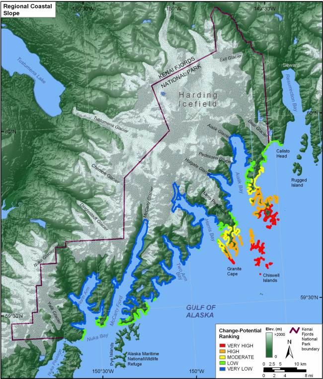
Figure 9. Regional coastal slope for Kenai Fjords National Park. The colored shoreline represents the regional slope of the land, 10 km landward and seaward of the shoreline. Very high change-potential coastal slope areas are where high mountains are adjacent to deep fjords. Moving seaward, coastal slopes become shallower further into the Gulf of Alaska, where the change in elevation is less dramatic. | ||
 |
||
