link to main US Geological Survey website
125 Years of Science for America - 1879 to 2004
U.S. Geological Survey
Open-File Report 2004-1390
Version 1.0

Real-time Forecasts of Tomorrow's Earthquakes in California: A New Mapping Tool

By Matt Gerstenberger, Stefan Wiemer and Lucy Jones

2004

map of California showing hazard zones in different colors
Hazard map calculated on August 2nd, 2004

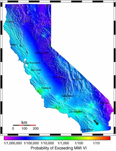
We have derived a multi-model approach to calculate time-dependent earthquake hazard resulting from earthquake clustering. This report explains the theoretical background behind the approach, the specific details that are used in applying the method to California, as well as the statistical testing to validate the technique. We have implemented our algorithm as a real-time tool that has been automatically generating short-term hazard maps for California since May of 2002, at http://step.wr.usgs.gov

Download this report as a 39-page PDF document (of2004-1390.pdf; 1 MB)

For questions about the content of this report, contact Matt Gerstenberger

Version history


Download a current version of Acrobat Reader for free

| Help | PDF help | Publications main page | Open-File Reports for 2004 |
| Privacy Statement | Disclaimer | Accessibility |
| Geologic Division | Earthquake Hazards Program |
This report is available only on the Web


| Department of the Interior | U.S. Geological Survey |
URL of this page: http://pubs.usgs.gov/of/2004/1390/
Maintained by: Michael Diggles
Date created: November 26, 2004
Date last modified: November 26, 2004 (mfd)