
Coastal Vulnerability Assessment of Virgin Islands National Park to Sea-Level Rise, USGS Open-File Report 2004-1398
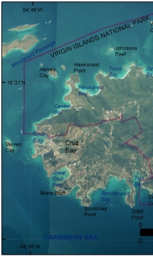
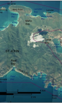
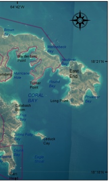
Figure 2. Virgin Islands National Park on St. John Island. Aerial photo mosaic produced from NOAA/NOS photos (http://biogeo.nos.noaa.gov/projects/mapping/caribbean/) showing physiography and location labels. The red line is the boundary of Virgin Islands National Park. | ||
 |
 |
 |
