
Coastal Vulnerability Assessment of Virgin Islands National Park to Sea-Level Rise, USGS Open-File Report 2004-1398
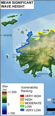
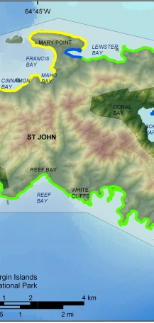
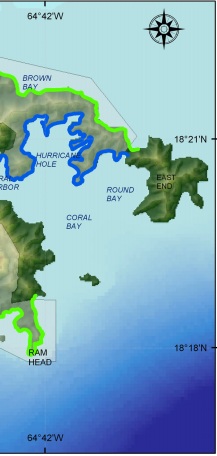
Figure 9. Mean significant wave heights for Virgin Islands National Park based on WIS data. The colored shoreline represents the significant wave heights within the park. Very high wave energy areas are located along the open Atlantic Coast. Significant wave heights are lower along the Caribbean Sea shoreline and vulnerability is moderate where the shoreline is protected from direct wave approach. | ||
 |
 |
 |
