
Digital Mapping Techniques '04— Workshop Proceedings
U.S. Geological Survey Open-File
Report 2004–1451
Cartography at the Montana Bureau of Mines and Geology
Montana Bureau of Mines and Geology, 1300 West Park Street, Butte, Montana 59701-8997; Phone: (406) 496-4173; Fax: (406) 496-4451; e-mail: ssmith@mtech.eduThis paper shows two of the Montana Bureau of Mines and Geology’s most recent publications. Each map was originally created in ArcInfo7 then transferred to FreeHand10 for final layout. The Lewis and Clark map in its final form has 10 layers of information. Each layer was exported as an .ai file from ArcInfo and imported into FreeHand. Tic marks common to each layer were used to register the layers. The line weights/colors, and font style/color were set in FreeHand and the relief map was added. City, mountain range and stream names, and the photographs, captions, main text, legend, and collar information were added in FreeHand. The Butte mine map with over 65 layers was imported layer by layer into FreeHand using MAPublisher5. The line weights and colors were set as each layer was imported. The headframes, text on the map, legend, graphics, main text file, and collar information were added in FreeHand.
MAP 1
Entitled “The Route and Campsites of Lewis and Clark in Montana: A Geologic Perspective”, by Robert N. Bergantino and Kenneth L. Sandau, this publication features a large map of Montana showing a detailed depiction of the Expedition’s route and campsites (Figure 1). There is also a sidebar of text explaining the geology of the Expedition, and nine photographs of specific landmarks as Lewis & Clark would have seen them, with appropriate quotes from their journals.
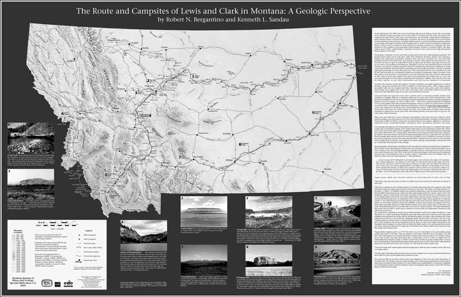 |
| Figure 1. Map 1, The Route and Campsites of Lewis and Clark in Montana. |
MAP 2
Entitled “Butte, Montana, Richest Hill on Earth; 100 Years of Underground Mining”, by Ted Duaime, Patrick J. Kennelly, and Paul Thale, this map is a compilation of previously unpublished historical information about the underground mines in Butte, as mapped by the Anaconda Copper Mining Company (Figure 2). The mine workings were plotted over an existing City of Butte base map showing existing streets, the outline of the Berkeley Pit, and the historical location of the Silver Bow Creek stream channel. The names and locations of seventy-four of the major mines are shown on the map. These mines are 1000 feet or more in depth and constitute over 80 percent of the total depth of the Butte mines. Also shown on the map are locations of the fourteen remaining headframes. Please see our website (http://www.mbmg.mtech.edu/)for other publications. Many of them are available as PDF files.
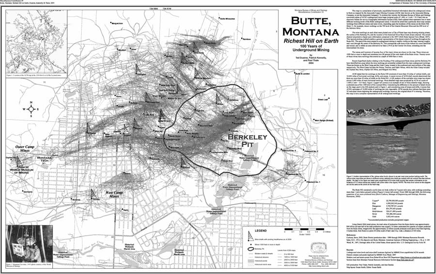 |
| Figure 2. Map 2, Butte, Montana, Richest Hill on Earth. |
REFERENCES
Bergantino, R.N., and Sandau, K.L., 2004, The route and campsites of Lewis and Clark in Montana: a geologic perspective: Montana Bureau of Mines and Geology Special Publication 116, scale 1:1,250,000.
Duaime, Ted, Kennelly, P.J., and Thale, Paul, 2004, Butte, Montana, richest hill on Earth; 100 years of underground mining: Montana Bureau of Mines and Geology Miscellaneous Contribution 19, scale 1:9,000.