
![]()
South Carolina Aeromagnetic and Gravity Maps and Data:
A Web Site for Distribution of Data
By David L. Daniels
Open-File Report 2005-1022
Online only
2005
![]()
Composite aeromagnetic anomaly map of South Carolina land and offshore areas at a simulated flight altitude of 1000 feet above ground or ocean (East illumination). Click on map to view larger image (1.0 MB).
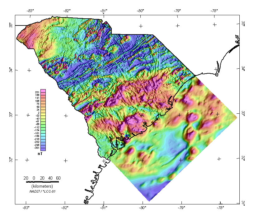
Grids for this map in several formats are available by using the "Get Data..." button.

Abstract: This web site gives the results of a USGS project to acquire the best available, public-domain, aeromagnetic and gravity data in the Eastern United States and merge into a uniform, composite grid for each state (link to other USGS state web sites). Files of state aeromagnetic and gravity grids and images are available for downloading. The results for South Carolina are presented here. This project was supported by the Mineral Resource Program of the USGS.
Link to the web site of the South Carolina Geological Survey
USGS Links - || USGS - Eastern Minerals Team || USGS - Geology Discipline || USGS - Home Page ||
Use of brand names is for descriptive purposes and does not constitute endorsement by the U.S. Geological Survey.