U.S. Geological Survey Open-File Report 2005-1025
Published 2006
Online only
Version 1.0
By Wayne L. Newell, Owen P. Bricker, and Meredith S. Robertson
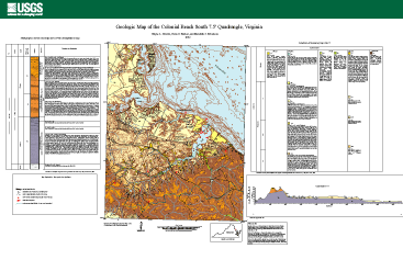 |
The Open-File Report includes a geologic map with cross section, and composite stratigraphic section of the Tertiary stratigraphy and of the Quaternary stratigraphy. The Tertiary map units are presented and interpreted for erodability and derived surficial deposits. The map area contains the George Washington Birthplace National Monument. The map facilitates the interpretation of the natural history of the Park including processes such as bog (wetlands) formation and coastal erosion. Two cores of Holocene estuarine deposits are sited on the map. They present the transition from terrestrial to estuarine depositional environments. |
This report is available in Adobe Reader PDF format (2.5 MB). Right-click (PC) or Control-click (Macintosh) to download the map. To download Acrobat Reader software, please visit the Adobe website.
For questions about the content of this report please contact Wayne Newell.

![]() U.S. Department of the Interior | U.S. Geological Survey
U.S. Department of the Interior | U.S. Geological Survey
URL: http://pubsdata.usgs.gov/pubs/of/2005/1025/index.htm
Page Contact Information: Publication Services Group
Page Last Modified: 22:00:10 Sat 12 Jan 2013
