|
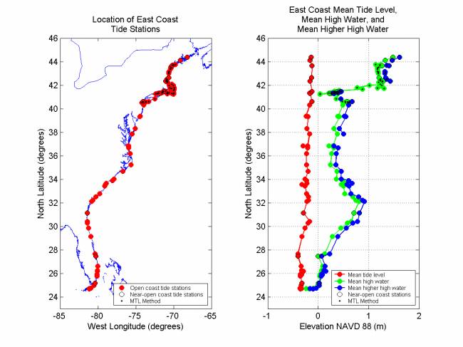
Figure 2. East Coast tide station locations and their tidal datum elevations. Station locations are shown on the left. Elevations of Mean Tide Level (MTL), Mean High Water (MHW), and Mean Higher High Water (MHHW) above NAVD 88 for each station are shown on the right. MTL is not plotted for stations at which the MTL Method was used. Stations where the MTL Method was used are a mix of open and near-open coast stations.
|