Figures 26-27.
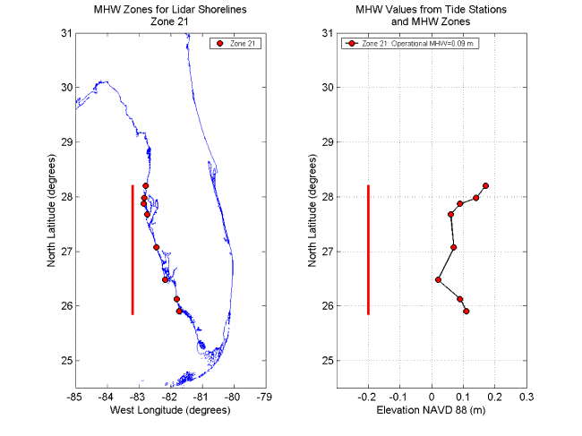
Figure 26. MHW Zone 21. Left panel shows the northern and southern extent of the zone, as well as the locations of the tide stations within this zone. Right panel shows the elevations of MHW for the tide stations in the zone and the northern and southern extents of the zone. The MHW elevations in this zone were averaged to determine the operational MHW elevation for the zone. The operational MHW for zone 21 is 0.09 m. Detailed information for this zone is found in Table 6.
|
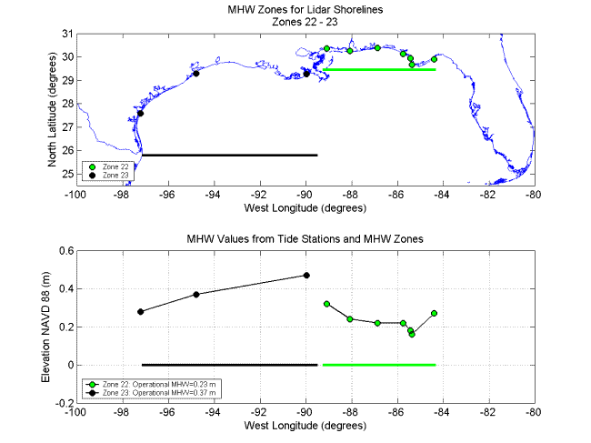
Figure 27. MHW Zones 22 and 23. Top panel shows the eastern and western extents of the two zones, as well as the locations of the tide stations within each zone. Bottom panel shows the elevations of MHW for the tide stations in each zone and the eastern and western extents of each zone. The MHW elevations in each zone were averaged to determine the operational MHW elevation for the zone. The operational MHW elevations are 0.23 m and 0.37 m in zones 22 and 23, respectively. Detailed information for each zone is found in Table 6.
|
[an error occurred while processing this directive]
[an error occurred while processing this directive] | |