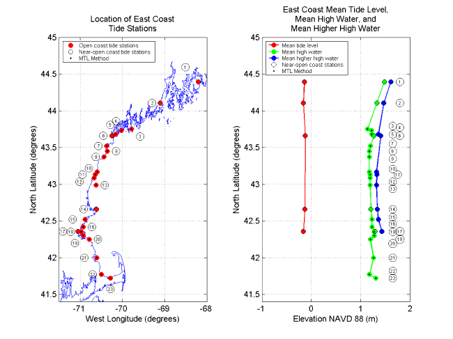
Figure 3. Tide station locations and tidal datum elevations along the East Coast from Maine to Barnstable, Massachusetts. Station numbers correspond to numbers in Table 1 (PDF Format) where detailed information for each station can be found. Mean Tide Level (MTL) is not plotted for stations at which the MTL Method was used. Stations where the MTL Method was used are a mix of open and near-open coast stations.
|
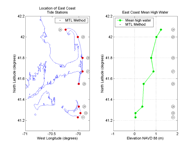
Figure 4. Tide station locations and tidal datum elevations for the outer coast of Cape Cod, Massachusetts, and Nantucket Island, Massachusetts. Station numbers correspond to numbers in Table 1 (PDF Format) where detailed information for each station can be found. Mean Tide Level (MTL) is not plotted for stations at which the MTL Method was used. Stations where the MTL Method was used are a mix of open and near-open coast stations.
|
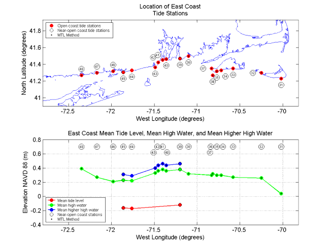
Figure 5. Tide station locations and tidal datum elevations along the coasts of Connecticut, Rhode Island, and the southern shores of Martha's Vineyard, Massachusetts, and Nantucket Island, Massachusetts. Station numbers correspond to numbers in Table 1 (PDF Format) where detailed information for each station can be found. Mean Tide Level (MTL) is not plotted for stations at which the MTL Method was used. Stations where the MTL Method was used are a mix of open and near-open coast stations.
|
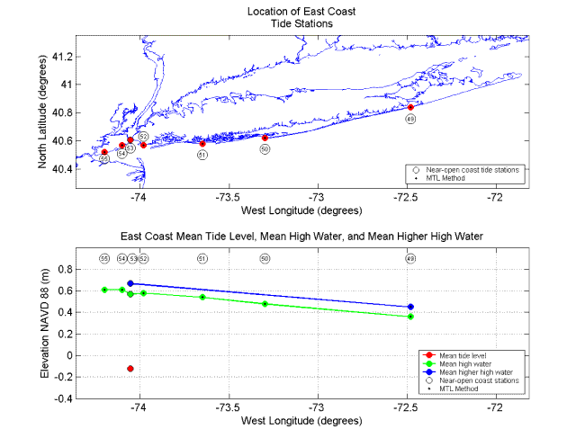
Figure 6. Tide station locations and tidal datum elevations for the southern shores of Staten Island, New York, and Long Island, New York. Station numbers correspond to numbers in Table 1 (PDF Format) where detailed information for each station can be found. Mean Tide Level (MTL) is not plotted for stations at which the MTL Method was used. Stations where the MTL Method was used are a mix of open and near-open coast stations.
|
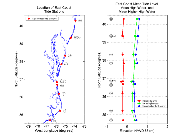
Figure 7. Tide station locations and tidal datum elevations from New Jersey to North Carolina. Station numbers correspond to numbers in Table 1 (PDF Format) where detailed information for each station can be found. The elevation of MHHW was not available for one of the stations at Virginia Beach, Virginia (station #61).
|
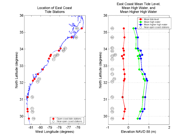
Figure 8. Tide station locations and tidal datum elevations along the East Coast from North Carolina to Florida. Station numbers correspond to numbers in Table 1 (PDF Format) where detailed information for each station can be found.
|
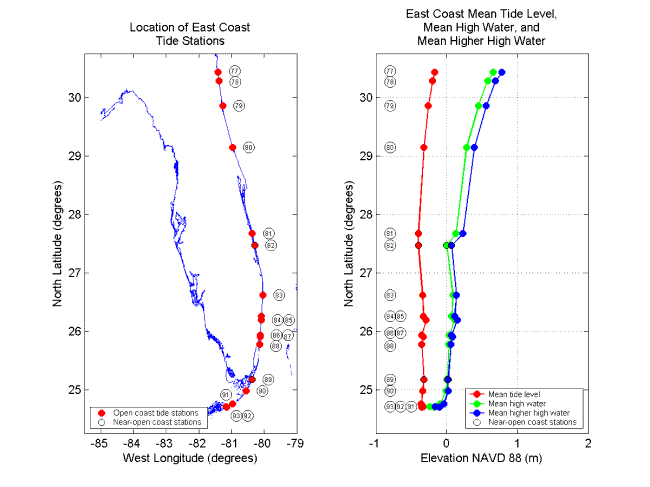
Figure 9. Tide station locations and tidal datum elevations along the East Coast of Florida. Station numbers correspond to numbers in Table 1 (PDF Format) where detailed information for each station can be found.
|
[an error occurred while processing this directive]
[an error occurred while processing this directive]