
U.S. Geological Survey Open File Report 2005-1040
Published 2005 - Online Version 1.0
Fracture Trace Map and Single-Well Aquifer
Test Results in a Carbonate Aquifer in
Berkeley County, West Virginia
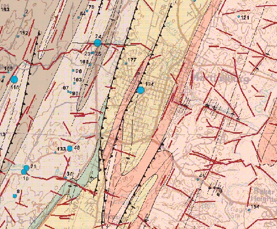
Above: Thumbnail image
of a portion of the fracture trace map of Berkeley County, WV
(Data and graphics files below include the entire study area and explanation
of map symbols).
| Abstract These data contain information on the results of single-well aquifer tests, lineament analysis, and a bedrock geologic map compilation for the low-lying carbonate and shale areas of eastern Berkeley County, West Virginia. Efforts have been initiated by management agencies of Berkeley County in cooperation with the U.S. Geological Survey to further the understanding of the spatial distribution of fractures in the carbonate regions and their correlation with aquifer properties. This report presents transmissivity values from about 200 single-well aquifer tests and a map of fracture-traces determined from aerial photos and field investigations. Transmissivity values were compared to geologic factors possibly affecting its magnitude. |
Data Available in this Report
 Fracture
Trace Map and Single-well Aquifer Test Results
(berkeley_fractures.zip)
-- Complete OF 2005-1040 map plate (McCoy and others, 2005: PDF format,
3.53 MB)
Fracture
Trace Map and Single-well Aquifer Test Results
(berkeley_fractures.zip)
-- Complete OF 2005-1040 map plate (McCoy and others, 2005: PDF format,
3.53 MB)
Readme
file with file structure of data and other miscellaneous
information (.txt format)
Base
map, based on 1:100,000 scale topographic map, available
as a compressed georegistered .tiff file: (base_drg.zip,
1.15 MB)
Metadata
available in compressed .html files: (metadata.zip,
21 KB)
GIS
data available as both compressed shapefiles and personal
geodatabase files. An ArcMap file (berkeley_OF.mxd) is included for display
of the personal geodatabase data set (This requires ArcGIS V. 8.3 and above):
(GIS_data.zip 2.22 MB)
Direct questions and comments to:
David J. Weary
U.S. Geological Survey
Email to: dweary@usgs.gov
Phone (703)-648-6113
U.S. Department of the Interior, U.S. Geological Survey
URL: http://pubsdata.usgs.gov/pubs/of/2005/1040/index.html
Maintained by Eastern Publications Group
Last modified: 21:10:59 Sat 12 Jan 2013
Privacy statement | General disclaimer | Accessibility