 |
Coastal Vulnerability Assessment of National Park of American Samoa to Sea-Level Rise
USGS Open-File Report 2005-1055
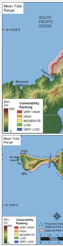
Figure 12. Vulnerability ranking for mean tidal range in the National Park of American Samoa. The colored shoreline represents the ranked mean tidal range for Tutuila and the Manu'a Islands. Tutuila is very high vulnerability (< 1 m) and the Manu'a Islands are high vulnerability (1 - 2 m). | ||
 |
 |
 |
 [an error occurred while processing this directive]