 |
Coastal Vulnerability Assessment of National Park of American Samoa to Sea-Level Rise
USGS Open-File Report 2005-1055
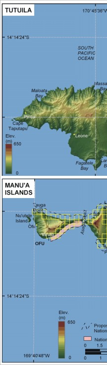
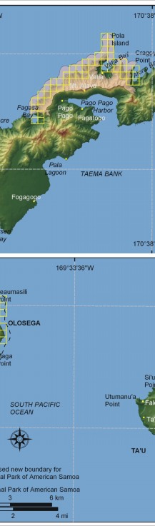
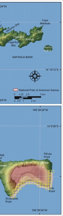
Figure 3. Shoreline grid for National Park of American Samoa. Each cell is approximately 500 meters of shoreline and represents a shoreline segment for which each variable is defined. | ||
 |
 |
 |
 [an error occurred while processing this directive]