 |
Coastal Vulnerability Assessment of National Park of American Samoa to Sea-Level Rise
USGS Open-File Report 2005-1055
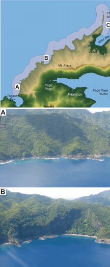
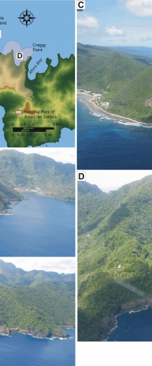
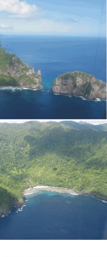
Figure 4. Photographs of geomorphic features on Tutuila in the National Park of American Samoa. The map at the top left is showing the locations of photos A - D. A) A view of the rocky coast north of Fagasa Bay; vulnerability is low to very low. B) A slope failure is noticeable in the center of the photo, the alluvium (center) is ranked as moderate vulnerability and the surrounding cliffs are low vulnerability. C) Pola Island was ranked as very low vulnerability while the mainland is moderate vulnerability due to the presence of fringing coral reef. D) The small embayment between Vatia and Afono Bay is ranked as moderate vulnerability, while the surrounding cliffs are low to very low vulnerability. | ||
 |
 |
 |
 [an error occurred while processing this directive]