 |
Coastal Vulnerability Assessment of National Park of American Samoa to Sea-Level Rise
USGS Open-File Report 2005-1055
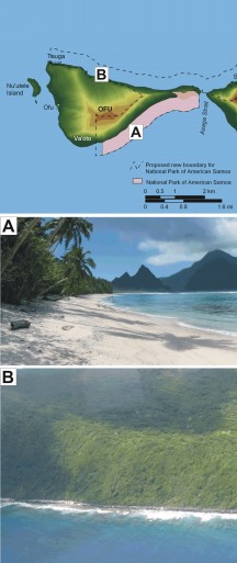
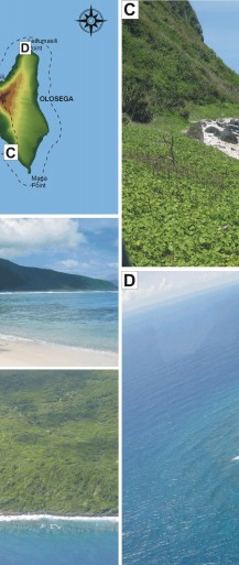
Figure 5. Photographs of geomorphologic features on Ofu and Olosega in National Park of American Samoa. The map at the top left is showing the locations of photos A - D. A) A view of the carbonate sand beach on the south side of Ofu; vulnerability is ranked as very high. B) The beach along the north coast contains more rubble and rock than the south coast, therefore ranked somewhat lower as high vulnerability. C) A coral rubble and rock beach along the southwest side of Olosega, high vulnerability. D) Leaumasili Point transitions from low vulnerability cliffs on the east side (left) of Olosega to high vulnerability beach (right). | ||
 |
 |
 |
 [an error occurred while processing this directive]